 KL Observer
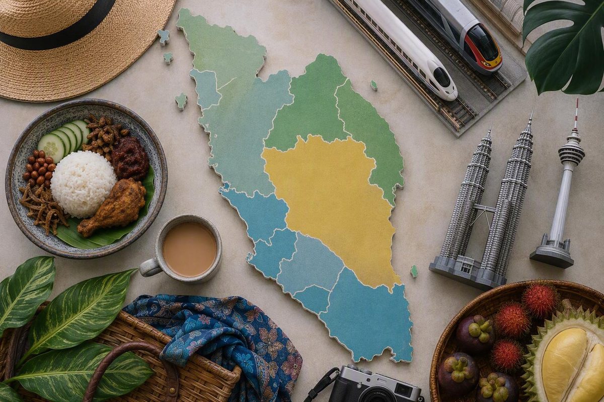
First, what does “Malaysian Peninsula” mean?
Terminology at a glance
- Malay Peninsula: The larger, multinational landform extending south through the southernmost part of Myanmar, southern Thailand, and Peninsular Malaysia.
- Peninsular Malaysia: Malaysia’s western region, occupying the southern part of the Malay Peninsula and including island territories belonging to its constituent states.
- West Malaysia: Another name for Peninsular Malaysia.
- Malaysian Peninsula: A common but less precise expression usually intended to mean Peninsular Malaysia, not the entire Malay Peninsula.
The essential distinction is that the Malay Peninsula and Peninsular Malaysia are not the same geographic unit.
Related: Best Time to Visit Malaysia: Match Dates to Your Route.
The Malay Peninsula is the larger north–south landform. It extends through the southernmost part of Myanmar and southern Thailand before continuing into Malaysia. Peninsular Malaysia occupies its southern portion. In other words, one term names a multinational physical feature; the other names a particular region of Malaysia within it. Britannica’s overview of the Malay Peninsula describes the broader geographic scope.
Peninsular Malaysia is also called West Malaysia, distinguishing it from East Malaysia on and near Borneo. The South China Sea separates the two regions. Kuala Lumpur and Putrajaya are in Peninsular Malaysia, while Sabah, Sarawak, and Labuan are in East Malaysia. Britannica identifies Peninsular Malaysia as West Malaysia and distinguishes it from East Malaysia across the South China Sea.
“Malaysian Peninsula” appears in general and travel-oriented English as another name for Peninsular Malaysia. It is understandable, but Peninsular Malaysia is more precise because it clearly identifies the Malaysian region rather than sounding like an alternative name for the entire Malay Peninsula.
There is another useful distinction between physical geography and administrative geography. Peninsular Malaysia is not limited to land physically attached to the Asian mainland. Its constituent states include island territories. Penang Island and the Langkawi archipelago, for example, are offshore but belong to states within Peninsular Malaysia.
That does not make “Malay Peninsula” and “Malaysian Peninsula” universally interchangeable. Throughout this guide, Malaysian Peninsula is used in the sense most travelers are likely to intend: Peninsular Malaysia. When the subject is the larger landform crossing national boundaries, the term Malay Peninsula is used explicitly.
Where Peninsular Malaysia is—and what it includes
Peninsular Malaysia lies immediately south of Thailand and north of Singapore. The Strait of Malacca separates its western side from the Indonesian island of Sumatra, while the South China Sea lies to the east. That sea also creates the substantial physical separation between Peninsular Malaysia and the Malaysian territories on Borneo.
The western side faces the maritime corridor of the Strait of Malacca. Between the two lies a mountainous and forested interior that makes the peninsula more than a simple line of coastal destinations.
Peninsular Malaysia comprises 11 states:
- Johor
- Kedah
- Kelantan
- Malacca
- Negeri Sembilan
- Pahang
- Penang
- Perak
- Perlis
- Selangor
- Terengganu
It also contains two federal territories:
- Kuala Lumpur, Malaysia’s national capital
- Putrajaya, the federal administrative centre
The state composition, federal territories, boundaries, and approximate area are summarized in the geographic overview of Peninsular Malaysia. The region covers approximately 131,956 square kilometres; that figure applies to Peninsular Malaysia, including relevant island territories, and not to the larger Malay Peninsula.
Two island examples are especially important for travelers.
Penang is a state, not simply an island. Penang Island is offshore and should not be described as physically attached to the peninsula. The mainland part of the state is contiguous with the peninsula’s landmass.
**** It appears in Peninsular Malaysia itineraries because it belongs administratively and practically to the region. It is not part of the mainland landform.
This distinction matters when reading maps and itineraries. A physical map of the mainland may omit islands that are important to travel planning, while a travel guide may use “the peninsula” broadly enough to include ferry or air connections to island territories.
How to read an orientation map
A useful map of Peninsular Malaysia should show:
- Thailand immediately to the north and Singapore at the southern end;
- Sumatra to the west across the Strait of Malacca;
- the South China Sea to the east;
- the boundaries of all 11 states;
- Kuala Lumpur within the western urban corridor;
- Penang Island separately from Penang’s mainland section;
- Langkawi offshore near the northwestern coast; and
- East Malaysia on Borneo, or a directional marker showing that it lies farther east across the South China Sea.
The result is not a picture of attractions evenly distributed along one narrow strip. Peninsular Malaysia is large and varied enough for its western corridor, east coast, central highlands, and interior valleys to function as distinct travel environments.
Mountains, forests, coasts, and the question of scale
The Titiwangsa Mountains form the principal mountainous backbone of the Malay Peninsula. Mount Tahan, at 2,187 metres, is the peninsula’s highest point. These features and the elevation are documented in Britannica’s geographic account of the Malay Peninsula.
That broad contrast should not be exaggerated into the claim that the interior is uniformly inaccessible. Roads, railways, towns, agricultural districts, highland settlements, and park gateways occupy or cross parts of it. Even so, substantial inland areas are more mountainous, forested, and rural than the heavily developed western corridor.
The peninsula contains tropical moist broadleaf forests at lower elevations and montane forests in higher terrain. It also supports threatened mammals including Asian elephants, tigers, sun bears, Malayan tapirs, and clouded leopards. This ecological context and species list are summarized in the Malay Peninsula geographic and ecological overview.
For travelers, that is context rather than a promise of wildlife sightings. A species occurring in a regional ecosystem does not mean a casual visitor will encounter it. Sightings depend on habitat, disturbance, guiding conditions, season, and chance. Plans should focus on appropriate access and low-impact conduct rather than treating rare animals as guaranteed itinerary experiences.
The interior also complicates a simple east-versus-west division. Cameron Highlands is inland rather than coastal. Taman Negara is better understood through its forest, river, road, and rail access than through a coast label. A state may be associated broadly with one side of the peninsula even when a particular destination within it is geographically central.
Why area figures do not agree
Published area figures for the Malay Peninsula vary substantially because sources are not always measuring the same geographic scope.
Britannica gives an approximate area of 181,300 square kilometres, based on its description of the larger peninsula. The figures should not be averaged or combined into a supposedly definitive measurement.
Several differences in scope may be involved:
- where the peninsula’s northern boundary is drawn;
- whether political or geomorphological limits are used;
- whether offshore islands are counted;
- how Singapore is treated; and
- which parts of Myanmar and Thailand are included.
Singapore illustrates the difficulty. It is physically an island, but some political, historical, or cultural descriptions include it within a broader peninsula region. A stricter physical-geography definition may treat it as a neighboring island rather than part of the mainland landform.
For clarity, keep three measurements separate:
- Peninsular Malaysia: approximately 131,956 square kilometres.
- Malay Peninsula under one narrower definition: approximately 181,300 square kilometres.
- Malay Peninsula under a broader definition: approximately 242,364 square kilometres.
These are not three competing measurements of one fixed administrative territory. They represent different definitions. For ordinary travel planning, the boundaries of Peninsular Malaysia are more useful than trying to establish a single maximum extent for the larger Malay Peninsula.
A practical three-zone view: west, east, and interior
A practical way to understand Peninsular Malaysia is to divide it into three broad planning zones:
- the western corridor;
- the east coast; and
- the mountainous and forested interior.
This is not an official administrative division. State boundaries do not always fit it, and some destinations sit between categories. Its value lies in showing how settlement, transport, terrain, and exposure to weather differ across the region.
The western corridor
Most of Peninsular Malaysia’s population and economic activity is concentrated in its western half. Kuala Lumpur and its surrounding urban region form the principal metropolitan anchor. Malacca, Ipoh, George Town, Butterworth, and the northern border corridor are commonly combined in west-side routes.
For first-time visitors focused on cities, built heritage, food, and established intercity rail, the west often provides the most straightforward route structure. That does not make it inherently better than the east or interior. It means only that a high concentration of urban destinations can reduce the number of complicated transfers.
Malacca lies south of Kuala Lumpur and is generally integrated through a road connection. Ipoh lies north along the western rail corridor. Butterworth is the mainland rail gateway for Penang, while George Town is on Penang Island. Langkawi requires an additional air or maritime transfer rather than functioning as a stop on the mainland rail line.
The west is not a single landscape. It includes large cities, port environments, agricultural districts, limestone country, highland access roads, and offshore islands. “Western corridor” is therefore a planning shorthand, not a promise of uniform scenery.
The east coast
The east-coast travel zone extends through Kelantan, Terengganu, and the eastern side of Pahang. Kota Bharu and Kuala Terengganu are important mainland centres, while the Perhentian Islands, Redang, and Tioman are commonly associated with this side of the peninsula.
An east-coast itinerary may depend more heavily on buses, road transfers, jetties, and boats than a city-focused western route. The coast and islands are also more exposed to the northeast monsoon. Heavy rain and rough seas can disrupt ferries, island access, and accommodation operations, according to the broad regional comparison in this east- and west-coast travel overview.
That source is commercial travel guidance rather than a live weather or transport authority. Its seasonal description is useful only for broad planning. It does not establish that an island will open or close on a fixed calendar date. Any route dependent on a boat requires a current check with the relevant operator and local weather or maritime notices.
The east is not solely a beach-transfer zone. Mainland towns, markets, religious buildings, crafts, and regional food traditions can form the substance of a trip. A traveler interested in the east coast need not make an island the centerpiece.
The interior
The interior is more mountainous, forested, and rural overall, but it also contains towns, roads, plantations, river valleys, and established visitor destinations. Taman Negara, Cameron Highlands, Jerantut, Kuala Lipis, Gua Musang, and Dabong represent very different inland environments.
Rail helps make this geography easier to understand. The East Coast Line is often called the Jungle Railway, although much of it runs through the peninsula’s interior rather than beside the coast. It passes inland communities, forested areas, limestone formations, agricultural landscapes, and smaller settlements. The railway’s role in connecting communities is as important as its appeal to leisure travelers, as described in the BBC’s account of the Jungle Railway.
Cameron Highlands shows the limits of the three-zone model. It is often placed in west-coast itineraries because of its road connections to western routes, but in terrain and travel character it is a highland destination. Treating it as part of the interior is more helpful when estimating transfers and deciding what kind of landscape a trip should include.
| Planning zone | Representative places | Typical landscapes | Transport character | Weather sensitivity | Well suited to |
|---|---|---|---|---|---|
| Western corridor | Kuala Lumpur, Malacca, Ipoh, Butterworth, George Town | Cities, heritage districts, lowlands, limestone areas, offshore islands | Established western rail spine and extensive roads; additional connections for islands | Rain can affect travel, but many routes do not rely on open-sea boats | Urban exploration, food, built heritage, multi-city routing |
| East coast | Kota Bharu, Kuala Terengganu, Perhentian, Redang, Tioman | Mainland coast, river mouths, settlements, islands, beaches | Road transfers combined with jetties and boats | More exposed to northeast-monsoon rain, rough seas, and ferry disruption | Mainland culture and island stays when current conditions permit |
| Interior and highlands | Taman Negara, Cameron Highlands, Jerantut, Kuala Lipis, Gua Musang, Dabong | Mountains, rainforest, river valleys, plantations, limestone formations | Roads, buses, minivans, and the interior East Coast Line | Rain, flooding, trail conditions, and long transfers can alter plans | Rainforest, highland scenery, inland rail travel, smaller settlements |
A short itinerary generally becomes more coherent when it selects one or two of these zones rather than trying to cover all three in equal depth.
Where to go, organized by what you want from the trip
There is no universal top-ten list for Peninsular Malaysia. A more useful question is: Which places match the experience and route you want?
The descriptions below are non-operational. They identify broad destination roles, not current transport schedules, opening conditions, or guaranteed activities.
For city exploration: Kuala Lumpur
Kuala Lumpur is the principal metropolitan gateway and a practical starting point for routes running north, south, or inland.
Batu Caves, Chinatown, Merdeka Square, the National Mosque, and the Petronas Twin Towers are frequently featured examples of places visitors consider. They are not a mandatory checklist. A day organized around one area or rail corridor is usually more manageable than repeatedly crossing the city to collect landmarks.
Where you stay changes how the city feels. Bukit Bintang, KLCC, and Chinatown offer different relationships between accommodation, rail access, food, nightlife, and walking. The Kuala Lumpur neighborhood comparison can help define a base before individual days are planned.
For heritage and food: Malacca and George Town
Malacca and George Town are often paired because both combine prominent food cultures with layered built environments. They should not be treated as interchangeable versions of one destination.
Its riverfront, civic buildings, religious sites, and shophouses support a relatively concentrated urban visit.
George Town, on Penang Island, reflects a long trading history through its shophouses, civic architecture, religious buildings, markets, street art, and food districts. Its culinary traditions draw on several communities, but reducing the city to a list of famous dishes misses the relationship between food and the surrounding streets.
In either place, food is easiest to enjoy as part of a district-based route. Allow time between meals and account for queues, heat, and rest rather than trying to consume every named specialty in one day.
For a smaller western-corridor city: Ipoh
Ipoh can serve as a smaller-city stop between Kuala Lumpur and northern destinations. Travel guides associate it with Chinese shophouse districts and nearby limestone caves. Its location on the western rail corridor can make it easier to combine with Kuala Lumpur and Butterworth than destinations requiring deeper inland transfers.
Ipoh may also act as a transition point in a journey involving Cameron Highlands or Penang. The workable order depends on current road and rail arrangements, so its role should be decided by routing rather than by its position on a simplified map.
For highland landscapes: Cameron Highlands
Cameron Highlands is associated with cultivated slopes, tea plantations, forest trails, and hill settlements. It provides a distinct contrast with Kuala Lumpur and the coastal lowlands. Rough Guides places tea plantations and forest trails at the center of the Cameron Highlands travel landscape.
Cameron Highlands is therefore a deliberate detour rather than an automatic addition to a western rail itinerary. It makes most sense when elevation, walking, and highland scenery are priorities.
For rainforest travel: Taman Negara
Taman Negara is a major rainforest destination. Depending on the entrance and the services operating at the time, reaching it may involve road transport, river transport, or transfers through a nearby town.
Jerantut is commonly identified in rail travel accounts as a gateway on the interior corridor. That does not mean the park can be reached conveniently by train alone. Travelers must still identify the intended entrance, onward transport, accommodation, permits or guide arrangements, and current access conditions.
Rainforest travel requires realistic expectations. A forest visit benefits from enough time for slower movement and weather-related changes.
For beaches and islands: choose the coast deliberately
Langkawi is a west-side island destination in Kedah with air and maritime access. It belongs within the broader travel geography of Peninsular Malaysia even though it is offshore.
The Perhentian Islands, Redang, and Tioman are east-coast alternatives. Because their access depends more directly on marine conditions and boats, weather and ferry operations play a larger role in itinerary design. Leave a buffer before international flights or other inflexible onward connections.
The west- and east-side islands are not substitutes in a simple contest over which has “better” beaches. Langkawi may fit a route involving Penang or northern Kedah. An east-coast island may fit a journey through Terengganu, Kelantan, or eastern Pahang. Transfer reliability and route geography should influence the decision as much as the desired setting.
For slow rail travel: the Jungle Railway corridor
Kuala Lipis, Gua Musang, Dabong, and Tumpat are associated with the Jungle Railway. They should not all be assumed to be fully developed visitor bases. Some primarily function as working towns, community centres, or transport points, and current accommodation and onward connections must be checked separately.
The corridor’s appeal lies partly in the journey: inland settlements, small stations, agricultural areas, forested terrain, and limestone landscapes. Choose a stop because it supports a clear purpose—an overnight break, a local connection, or access to a particular area—not simply because its name appears on the railway map.
Penang and Langkawi belong in peninsula guides for a related reason. Travel regions are shaped by administration and transport networks as well as by the strict outline of a landform. Both destinations are offshore, yet both are integral to many Peninsular Malaysia itineraries.
How the peninsula’s rail corridors fit together
At a stable, high level, Peninsular Malaysia’s railway geography can be understood through two principal corridors connected through Gemas:
- the West Coast Main Line; and
- the East Coast Line, often called the Jungle Line or Jungle Railway.
A third-party Peninsular Malaysia rail overview describes this two-corridor structure and identifies ETS, Intercity, and Komuter as broad service categories. These labels provide network context, not a guarantee that a particular service or route is operating on a selected date.
The West Coast Main Line connects the Thai-border area with major western population centres and continues toward the southern border area. Kuala Lumpur, Ipoh, and Butterworth are useful orientation points. Butterworth is on the mainland; reaching George Town requires an additional connection to Penang Island.
The East Coast Line runs between the south and Tumpat through the interior, with Gemas functioning as the junction between the broad western and eastern systems. The name “East Coast Line” can mislead first-time visitors because much of the route is inland.
“Jungle Railway” refers to the forested terrain and inland settlements associated with the route, not to a guarantee of uninterrupted rainforest outside the window. The railway also has two overlapping roles: it offers a slow-travel experience for visitors while continuing to connect inland communities.
Rail does not solve every itinerary. Additional transport is usually necessary for destinations or route segments such as:
- Cameron Highlands: a road transfer;
- Taman Negara: onward road and potentially river transport, depending on the entrance;
- Penang Island: a transfer from Butterworth;
- Langkawi: an air or maritime connection;
- east-coast islands: road transport to a jetty, followed by a boat;
- Malacca: generally a road connection rather than direct city-centre rail access; and
- cross-peninsula combinations: often a mixture of rail, buses, minivans, or other transfers.
The useful question is not merely “Can I travel by train?” It is: Which section does rail handle, and where must another mode take over?
Verify before committing
This rail overview is structural, not live operational guidance. Before booking, verify the intended date, station, service category, reservation requirement, interchange, cross-border procedure, and connecting ferry or road transfer directly with the relevant operator.
Historical travel accounts can show that a route existed and describe its character. They do not establish today’s fare, timetable, rolling stock, journey duration, onboard facilities, or booking rules.
A rail-based trip works best when it follows the network’s actual shape. The western line supports an urban corridor. The Jungle Railway supports a deliberate inland journey. Highlands, parks, and islands call for mixed transport.
Using Kuala Lumpur as a base and route-planning anchor
Kuala Lumpur is a practical starting point because it sits within the populated western corridor and can anchor routes toward Malacca, Ipoh, Penang, and Gemas. It is not geographically central to every destination, but it is a useful place to make the first major route decision.
Within the capital, KL Observer’s planning approach is to choose one base, use urban rail as the spine of each day, keep walks manageable, and leave room for heat, rain, meals, and rest. That first-party guidance establishes a Kuala Lumpur planning method; it does not demonstrate comprehensive authority over the rest of Peninsular Malaysia.
After choosing a neighborhood, the rail-and-walking guide can help connect a limited number of stations with shorter walks. A paced Kuala Lumpur stay can be part of the wider peninsula trip rather than a rushed prelude to it.
From the capital, three broad route shapes are useful.
Western heritage-and-food route
Kuala Lumpur → Malacca → Ipoh → George Town
This route combines the capital with two prominent heritage destinations and a smaller western-corridor city. It is broadly coherent, although Malacca lies south of Kuala Lumpur while Ipoh and Penang lie north. Depending on the arrival and departure points, travelers may visit Malacca first or accept one controlled reversal.
The framework suits an interest in cities, architecture, markets, and food. Rail can cover important northern segments, but Malacca and the final connection from Butterworth to Penang Island require additional transport.
Nature-and-highlands route
Kuala Lumpur → Taman Negara → Cameron Highlands
This framework exchanges the convenience of a single rail corridor for contrasting environments. Kuala Lumpur supplies the urban anchor, Taman Negara the rainforest component, and Cameron Highlands the elevated agricultural and forest landscape.
Road, bus, minivan, river, or other transfers may be required. The most efficient order can change with available services, so this should be treated as a route shape rather than a fixed day-by-day prescription.
It also needs more slack than the map may suggest. Rainforest and highland journeys can involve early departures, winding roads, weather exposure, and multiple access stages.
Rail-focused interior route
Kuala Lumpur → Gemas → selected Jungle Railway stops → Tumpat or another chosen endpoint
This route allows the railway itself to organize the journey. Gemas is the key junction, after which possible stopping points include Kuala Lipis, Gua Musang, and Dabong.
Selection matters more than quantity. One overnight stop and one purposeful inland visit may offer more depth than a rapid sequence of check-ins. Current departure times also determine whether important stretches are traveled in daylight and whether onward connections are practical.
How much fits into two weeks?
A third-party itinerary has divided a 14-day journey into four nights in Kuala Lumpur, three in Taman Negara, two in Cameron Highlands, three in Penang, and two in Malacca, with Ipoh suggested as an optional addition. That allocation appears in this two-week Peninsular Malaysia itinerary.
It is one example, not an ideal formula, and it relies substantially on road transport rather than making rail the organizing principle. Its main lesson is that even a relatively focused route can consume two weeks once transfers and meaningful stays are included.
Travelers often underestimate the complexity of combining both coasts, an island, highlands, rainforest, Kuala Lumpur, Malacca, Ipoh, and Penang in one short trip. Every additional zone introduces another transfer layer.
Start with a priority rather than a long destination list:
- If cities and food dominate, concentrate on the west.
- If an east-coast island is central, build the trip around verified marine and ferry conditions.
- If rainforest is the priority, protect enough time for access and guided activities.
- If the Jungle Railway is central, let the current timetable determine the route.
- If time is limited, choose one inland detour instead of automatically including both Taman Negara and Cameron Highlands.
Once the route shape is clear, the next task is to separate stable geographic knowledge from details that require a current check.
What to verify before turning the overview into an itinerary
Some information in this guide is relatively stable: terminology, state composition, broad coastlines, mountain systems, major cities, and the basic existence of western and interior rail corridors.
Operational details are different. Timetables, reservation rules, ferry operations, park access, accommodation availability, border procedures, health requirements, and local disruptions can change. The supplied evidence does not establish live conditions for any particular travel date.
Before booking, check:
- Train timetables: Confirm dates, stations, service category, interchange points, and arrival times with the railway operator.
- Reservations: Determine whether advance booking is required and whether seats or berths are available.
- Ferry and boat operations: Confirm the correct jetty, check-in process, marine conditions, and final viable connection with the relevant operator.
- Island accommodation: Verify that the property is operating and that arrival transport matches its reception or transfer arrangements.
- Park access: Check entrances, permits, guide requirements, trail closures, boats, and accommodation rules with the relevant park authority or provider.
- Severe weather: Review current official forecasts, warnings, flood information, sea conditions, and local disruption notices.
- Border rules: Confirm requirements for each traveler, passport, crossing, and transit arrangement with the relevant immigration authorities.
- Visas and health requirements: Use current official information applicable to citizenship, travel history, and destination.
- Accessibility: Ask providers directly about step-free routes, lifts, boarding assistance, accessible rooms, boat access, trail surfaces, and transfer vehicles.
- Local closures: Check holidays, maintenance, events, and temporary transport suspensions.
Broad monsoon patterns can help compare regional exposure, but they do not guarantee dry weather on the west or disruption on the east on any particular day. Short-term conditions can affect marine transport even when services are generally available.
The same distinction applies to train reports. A historical account may demonstrate that a route served particular towns and describe the journey’s character. It cannot establish today’s fare, timetable, equipment, amenities, or connection time.
Flexibility is especially valuable around:
- long rail or bus journeys;
- island arrivals and departures;
- park transfers;
- highland roads;
- days involving several transport modes;
- connections to international flights; and
- outdoor plans exposed to heat or rain.
A buffer need not be an entirely empty day. It can be a lightly planned city day, a flexible meal stop, or an extra night in an anchor destination. Its purpose is to prevent every stage of the trip from depending on the previous transfer working perfectly.
A compact planning sequence keeps the process manageable:
- Define the geographic scope. Decide whether you mean Peninsular Malaysia or the larger Malay Peninsula.
- Choose one or two zones. Select the western corridor, east coast, interior, or a deliberate combination.
- Select an anchor city. Kuala Lumpur is common, but George Town, Butterworth, Johor Bahru, Kota Bharu, or another hub may fit better.
- Identify required transfers. Mark every place where rail gives way to road, ferry, boat, or local transport.
- Verify current operations. Check operators, official weather services, park authorities, immigration information, and local notices.
- Add food, walks, and rest. Fill in the days only after the transport structure works.
Peninsular Malaysia rewards selective planning. Its western corridor, east coast, and interior are connected, but they are not interchangeable. Kuala Lumpur can provide a manageable starting point, while the final route should follow the traveler’s priorities and remain responsive to current transport, weather, ferry, park, and border information.
Frequently asked questions
Is the Malaysian Peninsula the same as Peninsular Malaysia?
Usually, yes. In common travel usage, “Malaysian Peninsula” generally means Peninsular Malaysia, also called West Malaysia.
The terms are not universally interchangeable, however. Malay Peninsula refers to the larger multinational landform extending through parts of Myanmar and Thailand as well as Malaysia. Peninsular Malaysia is the clearer name for the Malaysian region occupying its southern portion.
Which states and federal territories are in Peninsular Malaysia?
The 11 states are Johor, Kedah, Kelantan, Malacca, Negeri Sembilan, Pahang, Penang, Perak, Perlis, Selangor, and Terengganu.
The region also contains the federal territories of Kuala Lumpur and Putrajaya. Kuala Lumpur is Malaysia’s national capital, while Putrajaya is the federal administrative centre.
Penang includes an offshore island and a mainland section. Langkawi, in Kedah, is another offshore territory commonly included in Peninsular Malaysia travel coverage.
Is Singapore part of the Malay Peninsula?
Singapore is physically an island, separated from the peninsula’s southern mainland.
Whether it is included in the broader Malay Peninsula depends on the definition. Some political, historical, or cultural descriptions include Singapore within a wider peninsula region, while stricter physical-geography descriptions treat it as a neighboring island. The most accurate approach is to state the definition rather than claim universal inclusion or exclusion.
Why do sources give different areas for the Malay Peninsula?
Sources may use different northern boundaries, political territories, geomorphological limits, or rules for including islands and Singapore. Those choices produce substantially different estimates for the larger Malay Peninsula.
These estimates must remain separate from Peninsular Malaysia’s approximate area of 131,956 square kilometres. The latter refers to a defined Malaysian region; the former concern a broader landform whose scope varies among sources.
Can you travel across Peninsular Malaysia by rail?
Yes, but rail does not directly reach every destination. At a broad level, the western main corridor and the eastern or interior line connect through Gemas. The western route serves major population centres, while the East Coast Line—often called the Jungle Railway—passes through the interior toward Tumpat.
Rail can support journeys involving Kuala Lumpur, Ipoh, Butterworth, Gemas, Kuala Lipis, Gua Musang, and other connected places. Highlands, park entrances, islands, Malacca, and some cross-peninsula combinations require road, ferry, boat, or other transfers.
Always verify current trains, reservations, connections, and cross-border procedures with the relevant operators before committing to an itinerary.